Huawei Star Trace Positioning? Huawei introduced its Star Trace positioning technologies at its October 12, 2026 Terminal Innovation Technology Conference in Shanghai, outlining improvements across lane-level navigation, running-track positioning, tunnel guidance, underground parking, and indoor commercial navigation. According to on-site reporting, the system combines distinct techniques tailored to different environments, including HiSilicon short-range hardware paired with GNSS carrier-phase measurements for high-precision ranging, RTK with AI pedestrian dead reckoning for running tracks, and AI velocity estimation with geomagnetic matching for tunnels. Huawei reported sub-meter precision specifically for lane-level navigation, while its underground parking feature was presented with separate floor-identification and horizontal positioning metrics. Crucially for software engineering teams, the company has not publicly established that every specialized capability is accessible through third-party HarmonyOS location APIs.
Why Huawei Introduced Star Trace Positioning
At a Glance
- The architecture combines HiSilicon short-range connectivity chips with carrier-phase GNSS measurements, delivering a reported tenfold improvement in distance measurement precision for vehicular lane guidance.
- Scenario-specific sensor pipelines deploy real-time kinematic (RTK) positioning and AI pedestrian dead reckoning for running tracks, alongside geomagnetic matching for tunnels.
- Indoor tracking encompasses commercial mapping across five hundred thousand business district geofences, seventeen thousand indoor buildings, and floor-level resolution across more than thirty thousand underground parking garages.
Mobile location-based services (LBS) have historically operated within the physical constraints of satellite signal propagation. Conventional global navigation satellite systems (GNSS) deliver varying accuracy depending heavily on local satellite visibility, atmospheric interference, and structural multi-path reflections. In dense metropolitan environments, signals ricochet off high-rise buildings, while underground garages and vehicular tunnels sever direct line-of-sight entirely. Consequently, software applications frequently contend with spatial uncertainty, causing navigation displays to drift or jump across parallel surface streets and elevated highway ramps.
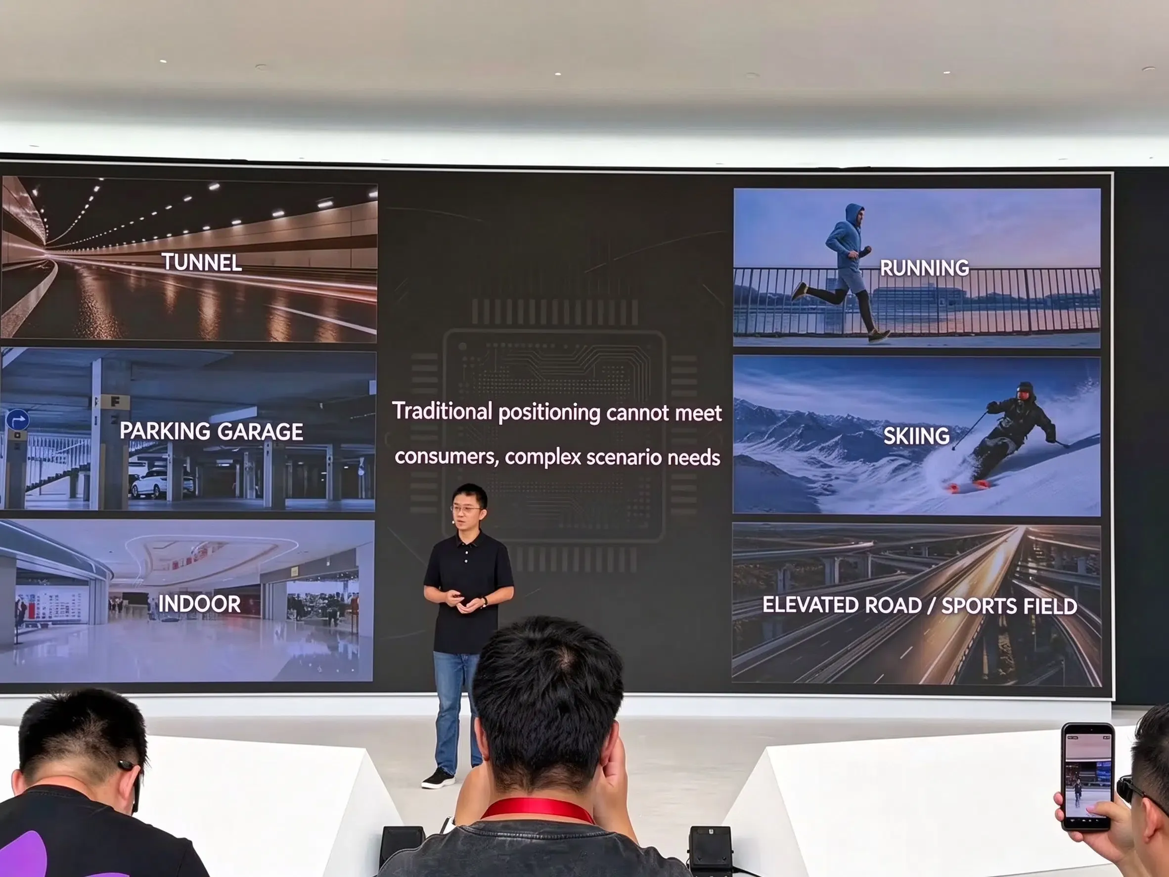
During the Huawei Terminal Innovation Technology Conference held at the Lianqiuhu R&D Center in Shanghai, hardware engineering leadership outlined how Star Trace positioning approaches these environmental constraints. Rather than relying on a single positioning receiver, the company presented distinct hardware-assisted methods aimed at urban canyons, highway tunnels, athletic tracks, ski resorts, and subterranean parking structures. The event focused on reducing positional ambiguity in complex environments, as detailed in ITHome’s conference overview and ITHome’s on-site Star Trace launch report.
How Star Trace Improves Lane-Level Navigation
The primary technical advance highlighted for vehicular transit is the integration of proprietary HiSilicon short-range connectivity silicon with satellite carrier-phase tracking. Standard satellite positioning relies primarily on pseudorange measurements, which calculate the transit time of radio codes broadcast by satellites. Because pseudorange signals are vulnerable to atmospheric distortion and multi-path reflections, their raw accuracy remains bounded by several meters of drift.
Carrier-phase positioning measures the phase of the satellite carrier signal itself, which operates at a significantly higher frequency and enables finer distance measurement. Huawei reports that combining short-range transceiver hardware with carrier-phase measurement achieves a more-than-tenfold improvement in ranging accuracy within this specific navigation subsystem.
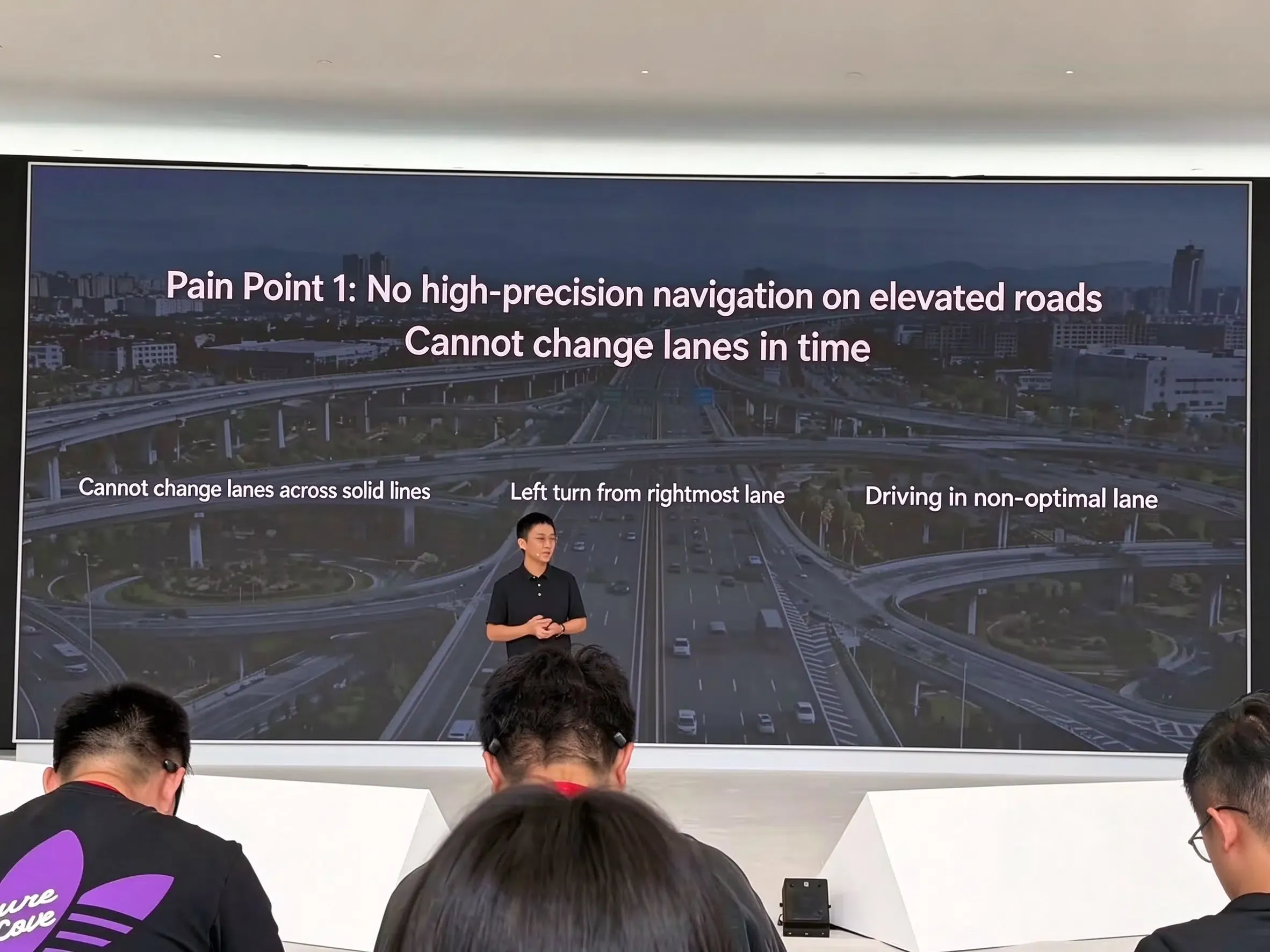
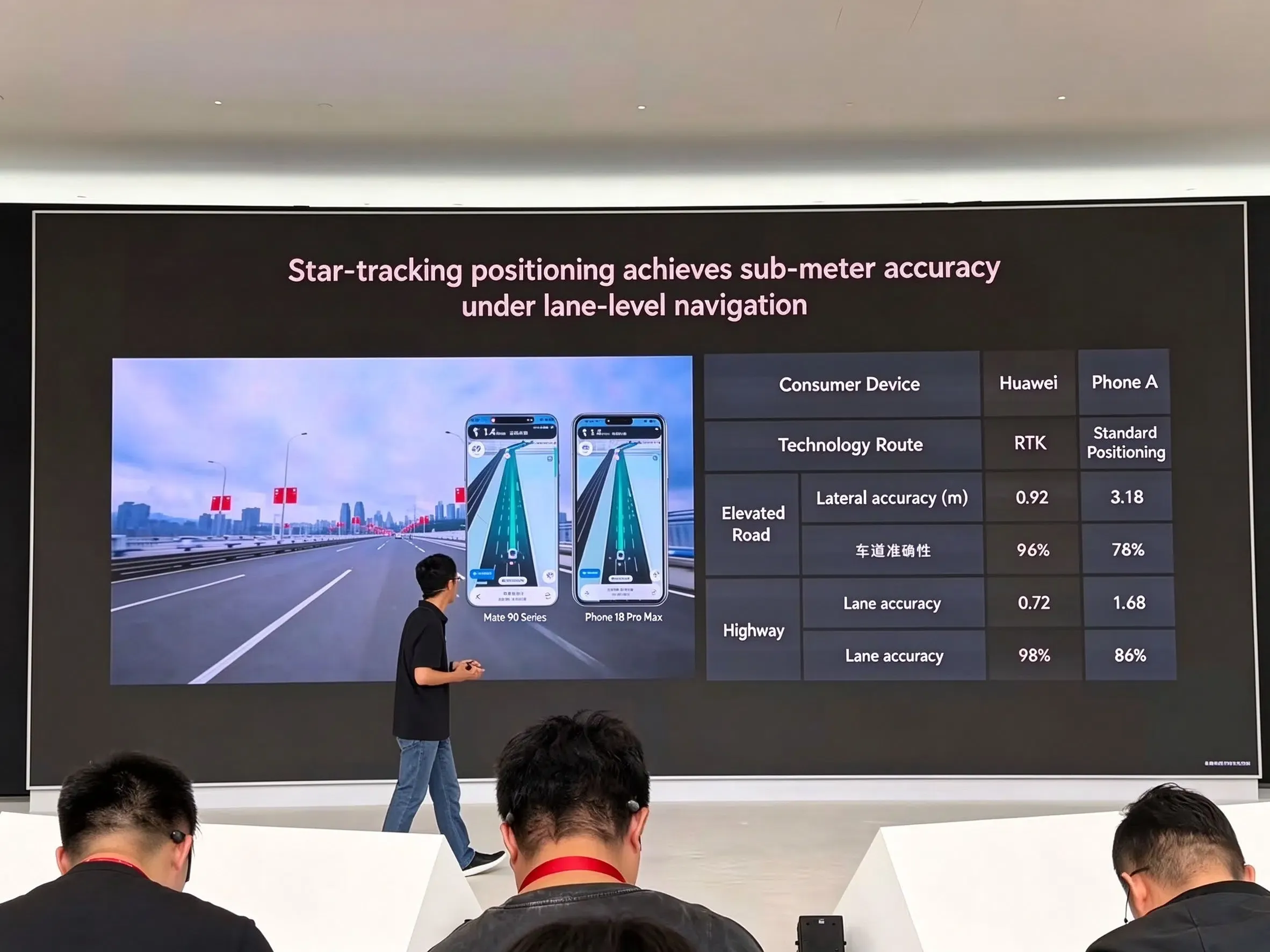
This ranging improvement forms the foundation for Huawei’s claim of sub-meter precision in lane-level navigation. For automotive routing, sub-meter resolution allows navigation engines to differentiate between main highway lanes, exit ramps, and high-occupancy vehicle lanes. This enables proactive lane-change recommendations prior to highway interchanges. However, this level of precision applies specifically to the announced vehicular highway scenario and should not be conflated with universal sub-meter performance across all terminal operating environments.
Running, Tunnels, Parking and Indoor Location
Beyond surface highway navigation, Huawei presented several tailored positioning techniques designed for specific physical environments where standard satellite reception fails or requires specialized filtering.
Athletic and Sports Tracking
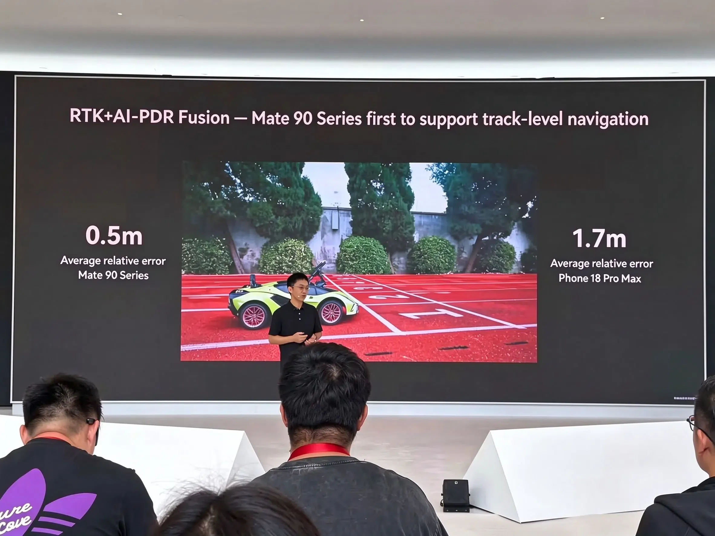
For competitive running and track sports, the Mate 90 series integrates real-time kinematic positioning with AI pedestrian dead reckoning (RTK + AI-PDR). This configuration is designed to identify individual running lanes on standard athletic tracks, filtering out step-induced body sway. On sports wearables, such as the WATCH GT Runner 2, hardware engineers introduced a three-dimensional suspended antenna array that achieves a 5.4 dB increase in GNSS signal reception compared with the first-generation device. In alpine skiing scenarios, a specialized GNSS and ski dead reckoning (SkiDR) fusion pipeline delivers a reported 98 percent distance accuracy, covering more than three thousand ski resorts with a 97 percent trail matching rate.
Tunnel Guidance via AI Velocity and Geomagnetics
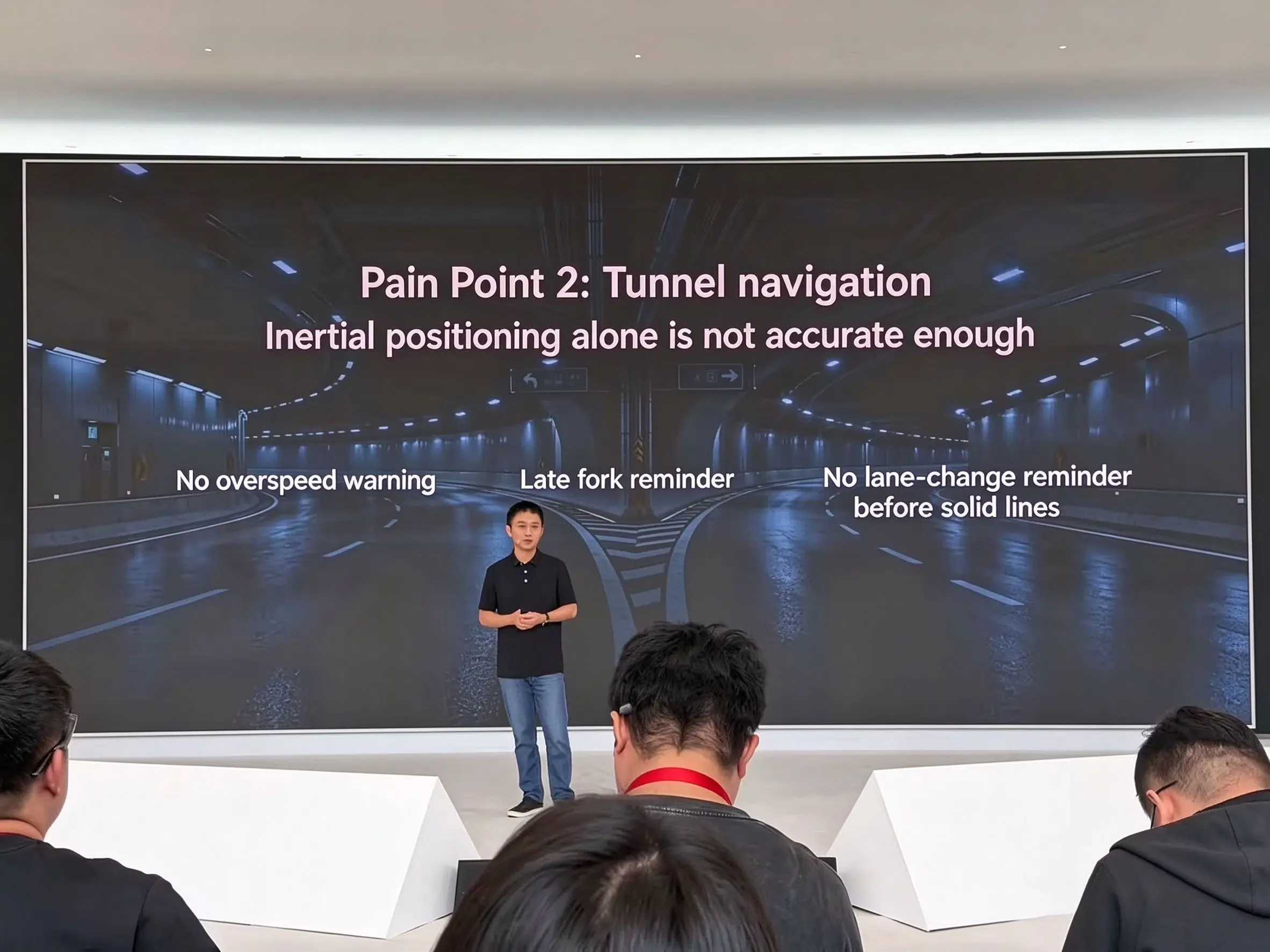
Highway tunnels represent a persistent failure point for satellite navigation because physical rock and concrete completely block RF reception. Huawei describes a combination of AI-based velocity estimation and geomagnetic matching to support tunnel navigation when satellite reception is unavailable. According to the launch presentation, comparing local magnetic signatures against mapped geomagnetic patterns allows the terminal to maintain longitudinal and lateral vehicle trajectory estimates. While presented as operating independently of tunnel length, this capability represents a vendor-reported metric. The company has not publicly disclosed the complete magnetic reference-data pipeline, matching algorithms, or operating limits across varying tunnel geometries and magnetic environments.
Subterranean Parking and Commercial Mapping
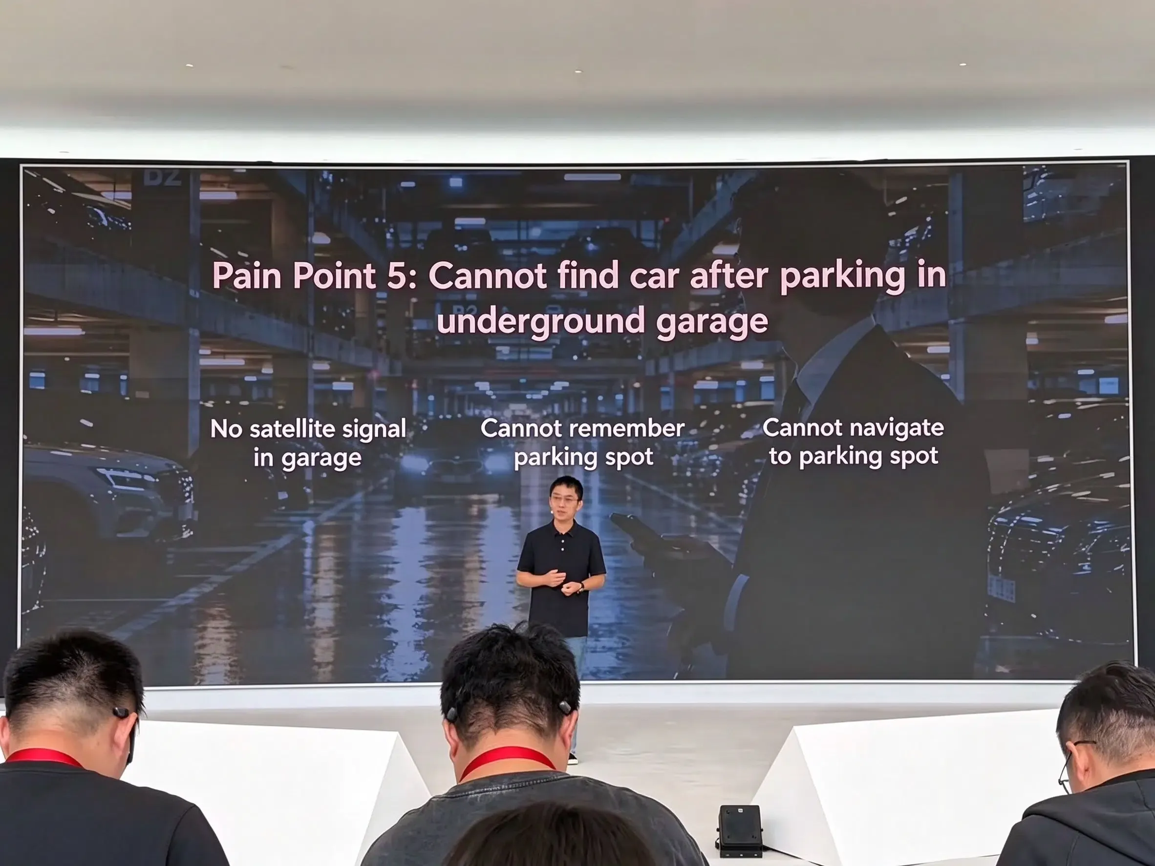
In multi-level underground parking facilities, Star Trace relies on three-dimensional road-network matching to track vehicle trajectories and record parked locations. The performance metrics disclosed for this environment differ significantly from surface vehicular navigation. Huawei reports a vertical floor-identification accuracy exceeding 95 percent and a horizontal positioning error of less than 10 meters, deployed across more than thirty thousand underground parking garages under the Accurate Car Search 2.0 feature.
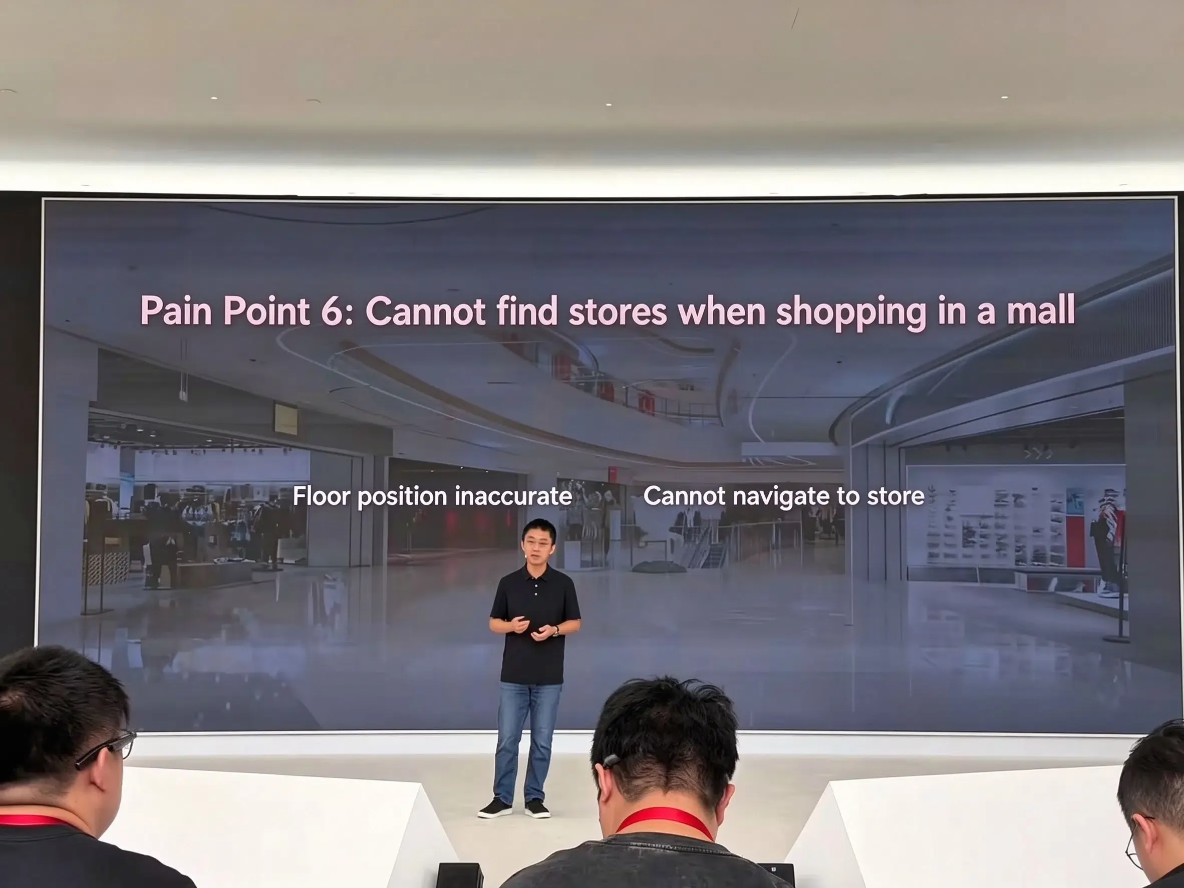
In commercial retail settings, the platform connects to five hundred thousand business district geofences and seventeen thousand indoor structures. Within Petal Maps, store-level indoor navigation is currently deployed across more than 260 shopping malls, with expansion ongoing.
Documented Positioning Scenarios
The following matrix summarizes the documented scenarios, corresponding technical approaches, and reported performance indicators as presented during the launch:
[Huawei Star Trace Positioning: Documented Scenarios]

  Lane-Level Navigation
    └── HiSilicon short-range chip + GNSS carrier-phase measurements
        └── Reported sub-meter lane-level precision

  Running-Track Navigation
    └── RTK + AI-PDR fusion
        └── Mate 90-series track-level positioning

  Tunnel Navigation
    └── AI velocity estimation + geomagnetic matching
        └── Reported lane-level guidance

  Underground Parking
    └── 3D road-network matching
        └── Floor identification accuracy >95%
        └── Positioning error <10 meters

  Commercial Indoor Navigation
    └── 500,000 commercial geofences
    └── 17,000 indoor positioning buildings
    └── Petal Maps store-level navigation in 260+ malls

[Implementation Details Not Publicly Specified]

  - Unified sensor fusion runtime
  - Sensor weighting and filtering algorithms
  - Raw GNSS / magnetic data access
  - Third-party Star Trace API availability
  - Battery cost and device-level accuracy guarantees
What HarmonyOS Developers Can Actually Access
For software development teams building on HarmonyOS, evaluating new hardware capabilities requires a clear understanding of public API boundaries. Huawei provides comprehensive location capabilities through the HarmonyOS Location Kit Developer Guide and the HarmonyOS Location Kit API Reference. These documentation portals detail support for standard fused location provider requests, geofence registration, and platform-level permission controls.
Huawei has demonstrated these specialized positioning capabilities in supported devices and services, including its own navigation experiences. However, the reviewed public documentation does not specify the internal service architecture or establish which Star Trace-specific outputs, if any, are exposed through third-party HarmonyOS APIs.
| Positioning Capability | Public API Status | Reported Resolution / Target | Operational Dependencies |
|---|---|---|---|
| Standard Fused Location | Publicly documented (HarmonyOS Location Kit) | Environment- and device-dependent; inspect reported accuracy | Device capability, available positioning signals, user permissions, and environmental conditions |
| Geofence Monitoring | Publicly documented (Location Kit Geofences) | Variable perimeter radii | OS background scheduling, power-saving restrictions |
| Lane-Level Sub-Meter Routing | Star Trace-specific third-party access not established | Sub-meter (Reported Claim) | HiSilicon short-range silicon, specialized carrier-phase pipeline |
| Tunnel Geomagnetic Guidance | Star Trace-specific third-party access not established | Lane-level guidance (Reported Claim) | Pre-mapped geomagnetic database, supported terminal hardware |
| 3D Garage Floor Identification | Star Trace-specific third-party access not established | Floor >95%, horizontal <10m (Reported Claim) | Pre-surveyed 3D facility maps, Accurate Car Search 2.0 |
| Commercial Store Navigation | Petal Maps capability reported; third-party integration scope requires verification (Petal Maps Platform) | Individual merchant stalls | Mapped commercial indoor venues, Petal Maps integration |
Developers designing commercial location services should verify actual coordinates returned by standard system location listeners across various terminal models. Do not assume third-party applications will automatically receive sub-meter coordinates without specialized platform entitlements or dedicated developer framework updates.
Developer Checklist for High-Precision Location Apps
Engineering teams creating navigation, logistics, and location-aware applications should incorporate structured technical checks when working with high-precision positioning data.
Position Accuracy & Metadata Verification
- Validate Coordinate Accuracy Estimates: Always inspect horizontal and vertical accuracy metadata fields returned by platform location callbacks rather than assuming fixed sub-meter precision.
- Implement Coordinate System Harmonization: Ensure that incoming coordinate streams correctly reconcile geographic datums (such as WGS-84 and local Chinese GCJ-02 projections) before executing spatial queries.
- Deploy Graceful Accuracy Degradation: Design user interfaces to adapt smoothly when positioning confidence drops from high precision to standard cell-tower or Wi-Fi triangulation.
Permissions & Lifecycle Governance
- Enforce Tiered Permission Requests: Request approximate location access first, elevating to precise background location only when specialized navigation workflows explicitly require it.
- Manage Power and Polling Intervals: Throttle high-frequency location listener callbacks during background execution to prevent thermal throttling and battery consumption complaints.
- Account for OS Power-Saving Modes: Implement reconnect logic for location event streams that may be suspended when the operating system enters deep sleep or low-power states.
Spatial Testing & Edge-Case Validation
- Execute Multi-Path Testing in Urban Canyons: Benchmark application behavior in high-density downtown districts to evaluate drift during satellite signal reflection.
- Simulate Dead Reckoning Disconnects: Test application state persistence when simulated vehicles enter tunnels, ensuring routing algorithms do not fail abruptly upon GNSS dropout.
- Audit Location Privacy Compliance: Ensure that granular latitude and longitude traces comply with data minimization principles and local data residency statutes.
Frequently Asked Questions (FAQ)
How does Huawei report achieving sub-meter positioning accuracy?
What distinguishes Star Trace positioning from traditional RTK satellite navigation?
Can third-party developers directly access Star Trace positioning data?
Key Takeaways for Engineering Teams
The presentation of Star Trace positioning reflects an ongoing shift in mobile terminal design: hardware manufacturers are moving beyond basic satellite receivers toward tightly integrated, multi-sensor spatial computing stacks. By deploying distinct sensor combinations for vehicular highways, tunnels, athletic venues, and subterranean facilities, modern devices are increasingly capable of maintaining continuous spatial context.
For application engineers and product teams, this hardware evolution highlights the importance of distinguishing between vendor-showcased capabilities and public developer APIs. While operating system navigation services continue to push positional boundaries toward sub-meter and stall-level thresholds, third-party software architectures must remain resilient. Implementing robust coordinate validation, power-aware polling routines, and graceful fallbacks ensures that location-based applications deliver dependable performance across all operating environments.
References
Share this article